The east coast of Australia is currently being hit by a polar blast, which is causing precipitation (rain and snow) as well as a dip in temperature.
As a cold front moved through Victoria and Tasmania earlier this week, the Bureau of Meteorology forecasted rain and perhaps severe thunderstorms, including hail, for parts in the north-east of New South Wales. This was in response to the front’s passage through those states.
During the middle of the day on Tuesday, the temperature at Observatory Hill in Sydney was a pleasant 22 degrees. The city had a sunny start to the day.
On the other hand, temperatures dropped significantly throughout the afternoon, hitting approximately 11 degrees Celsius by 2.30 p.m.
On Wednesday morning, temperatures are forecast to fall to 7 degrees Celsius in Sydney and 5 degrees Celsius on the Central Coast, bringing with them a cold snap.
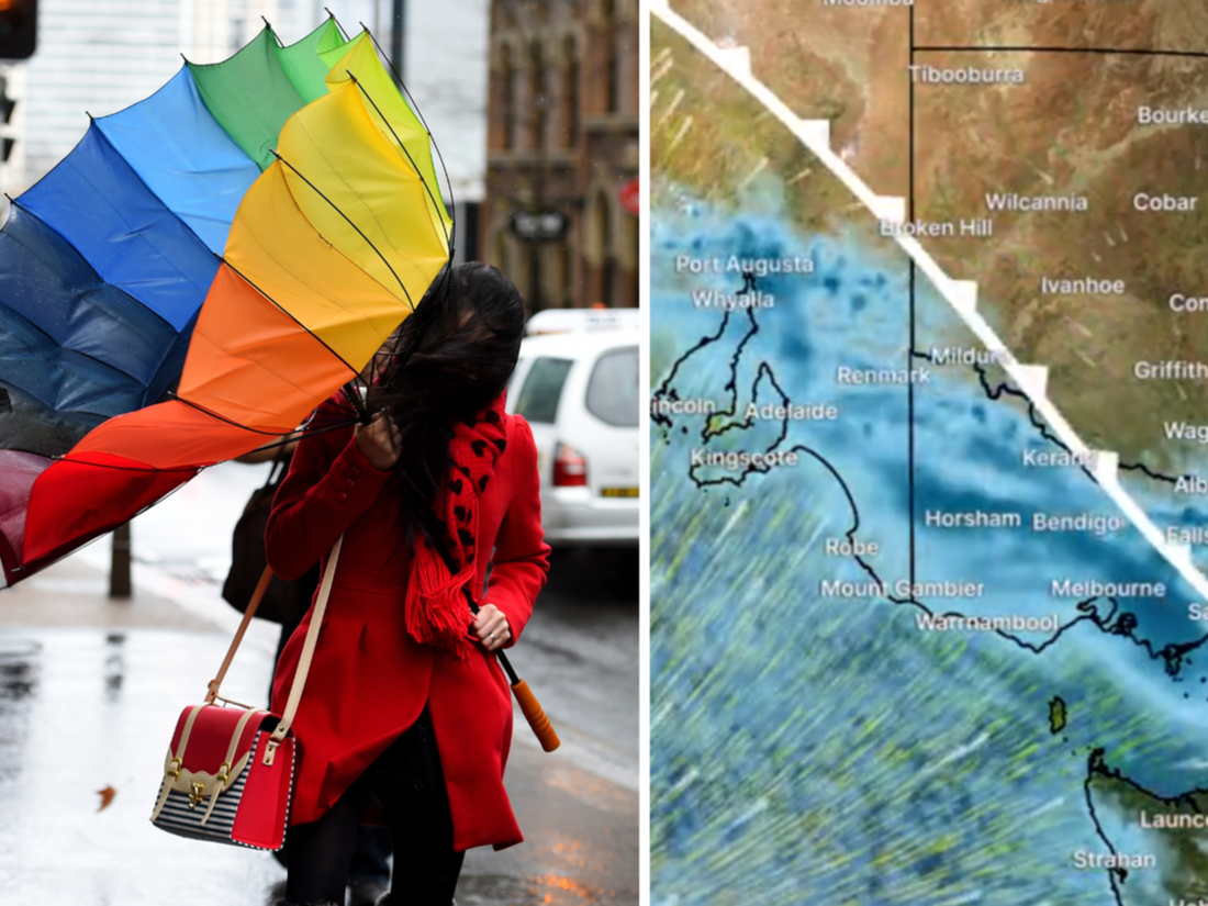
A strong front will cross SE #Aus on Mon, with very cold air moving across #SA, #Vic, #Tas, & #NSW. Snow to 300m possible for Tas; as low as 500m for the mainland. ????️????
⚠️ Check our website for warnings for cold, wet, & windy conditions over coming days: https://t.co/6Zo6dO0WPz pic.twitter.com/Dr3DniPciY— Bureau of Meteorology, Australia (@BOM_au) August 21, 2022
As a result of the dip in temperature, the Bureau of Meteorology forecasts that there will be some snow showers over the central and northern tablelands on Tuesday and Wednesday.
As the rain band that is accompanying the cold front moves closer to areas that are already prone to flooding, minor to moderate flood warnings have been issued for a number of rivers, including the Macquarie, Bogan, Lachlan, Murray, Tumt, and Murrumbidgee rivers.
As a result of the scattered showers that followed the front, Christie Johnson, a senior meteorologist with the Bureau of Meteorology, predicted that “some of these flood warnings would linger for many days,” given that a significant portion of those regions were already waterlogged.
The rest of this week will see Melbourne’s temperatures remain low, with the highest readings only reaching 13 and 14 degrees Celsius on Wednesday and Thursday, respectively.
Temperatures in Hobart are expected to hit 13 degrees on Wednesday, 15 degrees on Thursday, and 16 degrees on Friday.