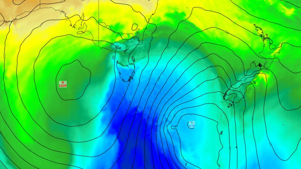
The first significant cold snap of the autumn season arrived in Australia over the weekend.
According to Weatherzone, the cold air moved in from the Antarctic Ocean over the course of Sunday and Monday.
It affected areas in Tasmania and south Australia.
Temperatures at Mt Wellington dropped to -1.8 degrees Celsius on Sunday.
In nearby Devonport, the low temperature was recorded at 3.8 degrees Celsius.
The cold weather also brought strong winds, with gusts of up to 130 kilometers per hour at Mt Wellington and up to 95 kilometers per hour in Hobart.
In Victoria, the temperature at Mt Hotham was -1.4 degrees Celsius. In NSW, the Cooma Airport recorded a low of only 1 degrees Celsius.
According to Weatherzone, the cold weather would be beneficial to Tasmanians, as this summer was the warmest on record in the state.
With mean temperatures of 1.17 degrees Celsius, it was the ninth-hottest recorded summer in the country. However, the reprieve will only last until Saturday, when the temperature in Hobart is expected to reach 33 degrees Celsius.
If the temperature reaches 33 degrees Celsius, it will not match the hottest recorded day in the city, which was on March 2, 2019, when the temperature reached 39.1 degrees Celsius.
Despite the cold weather, the Bureau of Meteorology is still predicting warm days and nights throughout the autumn season.
The end of El Nino is approaching, which is expected to result in below-average rainfall across most of the nation.
However, the Bureau noted that there is a high likelihood that autumn will bring an unusual high temperature.
Dr Lynette Bettio, a senior climate scientist, said that the likelihood of below-average rainfall across most parts of the country is around 60 to 70 percent.
However, the northern wet season is expected to contribute to high rainfall in the country’s tropical regions.
She urged residents to be prepared for severe weather.

