
If you thought the Aussie summer was all about tropical cyclones and heatwaves, think again!
A cold front is sweeping its way across Tasmania and into southern NSW and the ACT, bringing with it a welcome dose of cold air and even snow!
The Cold Front Cometh
By the end of the week and into the weekend, a cold front will bring unseasonably cold air to Tasmania, with snow likely in the highest parts of the state.
And if you’re a fan of skiing, you’ll be stoked to know that flakes could even fall at the highest elevations of Victorian and NSW ski resorts like Mt Hotham and Thredbo.
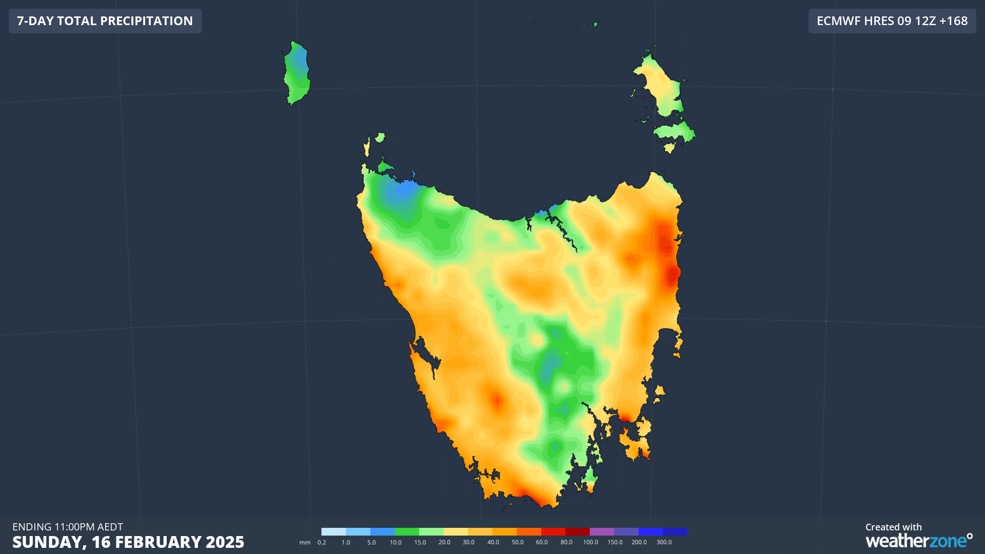
Relief for Tasmanian Bushfires
This cold front is a game-changer for Tasmanians who are currently battling serious bushfires.
The statewide soaking that’s coming with the cooler weather will bring widespread showers through to Sunday, giving firefighters a much-needed break.
The fires have already burnt out 30,000 hectares and forced the closure of the iconic Overland Track to walkers.
Drought Relief in Sight
The stats are staggering – Hobart has had less than 30mm of rain, Launceston less than 15mm, and even Queenstown on the west coast has had less than 20mm.
But by the end of the weekend, every corner of the state should get a decent drop, with falls on the west coast heavy enough to enable firefighters to gain a significant foothold on the state’s bushfires.
Melbourne and Canberra, Get Ready for a Chill!
Melbourne, you can expect maximums of just 19°C and 18°C on Saturday and Sunday – the coldest two-day spell of the summer so far!
And Canberra, you’ll feel a distinct overnight chill, with mornings reaching as low as 6°C on Sunday and Monday.
Meanwhile, Perisher and Thredbo are expected to dip to a very chilly -3°C on Sunday morning.
So, there you have it – the Aussie summer just got a whole lot chillier! Stay warm, and stay tuned for more updates on this wild weather!