

STORM ALERT: NSW Braces for ‘Most Prominent’ Thunderstorm Outbreak of the Season with Threat of Giant Hail and Damaging Winds
- Severe thunderstorms forecast to sweep across large parts of NSW, including Sydney, on Friday
- Winds, rain, and hail expected, with temperatures set to drop by up to 10C in just one hour
- Residents urged to stay up-to-date with severe weather warnings in their areas
One of the biggest storm outbreaks of the season is set to hit New South Wales on Friday, with the entire Sydney Metro area, Central Coast, Hunter Valley, Newcastle, and Mid North Coast bracing for impact. The Bureau of Meteorology has warned of a high chance of severe and widespread thunderstorms, bringing damaging winds, rain, and even giant hail.
“It’s certainly shaping up to be quite a stormy afternoon and evening for eastern and northeast NSW,” senior meteorologist Angus Hines said, warning that some storms could strengthen into severe thunderstorms.
A severe thunderstorm warning has already been issued for the southern ranges, which is expected to impact locations including Jindabyne, Perisher, and Thredbo. Sydney is forecast to be a hot and sunny Friday morning, reaching highs of 32C in the city and up to 34C in parts of the western suburbs, before the storms break out in the afternoon.
“Sydney is right in the heart of the severe thunderstorm risk for tomorrow,” Hines said, adding that the storms are expected to reach the city about 4pm on Friday, dropping temperatures by up to 10C in just one hour.
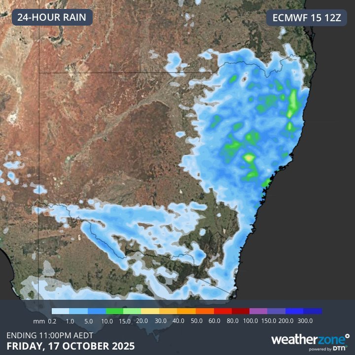
The outbreak is looking to be one of the biggest storm outbreaks of the 2025/26 storm season in NSW, with the Bureau of Meteorology urging residents to keep up-to-date with severe weather warnings in their areas.
Residents are advised to stay indoors and avoid traveling during the storm, with the potential for flash flooding, power outages, and property damage.