A broad high-pressure area is expected to move across southeast Australia this week, and it will bring with it a mixture of dry and windy weather, with the potential to heighten fire danger warnings in the country’s eastern and central regions.
Following a trough and a front through the region, the weather will become increasingly dry and windy, with the possibility of strong and gusting winds.
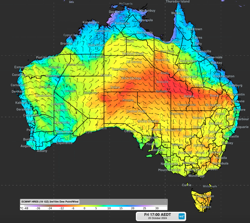
These images show the wind fields and dew point temperature that are expected to occur late this week.
The dew point, which is a vital atmospheric moisture indicator, is expected to drop below zero degrees Celsius in various areas, which will indicate the presence of dry air.
This combination of dry and windy weather will lead to an increased risk of bushfires in several areas, including the central and southern regions of NSW, the Northern Territory, and South Australia.
The winds are expected to become strong from Thursday to Saturday. The peak day is likely to occur on Thursday, with gusts of up to 45 to 55 kilometers per hour.
Due to how the reduction in moisture can increase the fire-flammability of vegetation, it’s important to keep in mind that these conditions can contribute to the spread of bushfires.
The strong winds could cause spot fires to ignite and carry embers over significant distances. These conditions can also contribute to the spread of bushfires.
Not only does this increase the risk of a massive fire outbreak, but it poses threats to people, ecosystems, and properties.
It is important for people in areas at high risk of bushfires to monitor the weather and take precautionary measures.

