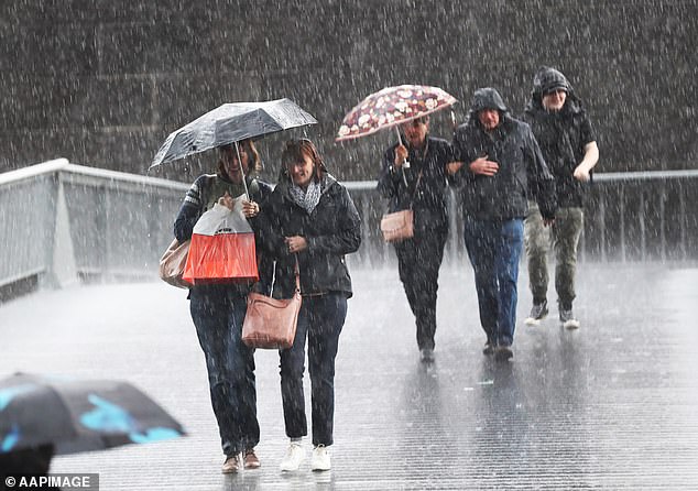
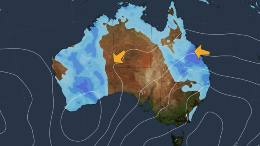
An intense deluge is making its way towards Queensland’s central coast, threatening to unleash over 200mm of rain after severe thunderstorms drenched inland areas with unprecedented rainfall.
Inland Towns Soaked by Severe Thunderstorms
On Wednesday night, powerful thunderstorms rolled through inland Queensland, bringing with them astonishing amounts of rain in a very short period. Lesdale, a town located approximately 700km west of Brisbane, was inundated with an incredible 92mm of rainfall in just one hour. Meanwhile, the nearby town of Charleville was pounded with 68mm during the same period, leading to waterlogged streets and rising water levels.
Residents in these inland communities were caught off guard by the sudden downpour, which led to minor flooding and disruptions. The heavy rain filled catchments and caused creeks and rivers to swell rapidly.
Flood Warnings for Warrego River
In response to the unexpected deluge, the Bureau of Meteorology issued a minor flood warning for the Warrego River at Charleville. The rapid accumulation of water has raised concerns about potential flooding in low-lying areas and downstream communities. Residents have been advised to stay alert and monitor the situation closely.

Weather System Moves Towards Central Coast
The weather trough responsible for the inland storms is now slowly making its way towards Queensland’s central coast, particularly targeting the region between Mackay and Rockhampton. On Wednesday, Mackay already experienced significant rainfall, recording 70mm within a 24-hour period. This is just the beginning, as meteorologists warn of heavier rain to come.
Bureau Predicts Heavier Rainfall Totals
The Bureau of Meteorology has forecasted that the trough will intensify over the next 24 hours. This development is expected to bring heavier rainfall totals exceeding 200mm on Thursday. Some communities, especially those situated between Sarina and Eungella, are being told to brace themselves for possible downpours of up to 300mm. Such significant rainfall amounts could have serious implications for these areas.
Risks Associated with Heavy Rainfall
The anticipated heavy rains pose several risks to the affected regions. Firstly, dangerous driving conditions are expected due to waterlogged roads and reduced visibility. There’s also the possibility of access routes being closed, which could isolate communities. Rivers and creeks are likely to reach or exceed their flood thresholds, increasing the risk of both flash flooding and riverine flooding.
Meteorologist Helen Reid highlighted the potential for sudden flooding, stating, “Areas of flash flooding are certainly possible throughout the day, anywhere that the higher rainfall may accumulate.” This means that even areas not traditionally prone to flooding could experience unexpected water levels.
Impact on Property and Agriculture
Beyond the immediate dangers to personal safety, the heavy rainfall could have detrimental effects on property and agriculture. The force of the water can damage homes, buildings, and infrastructure. Trees may be uprooted, and crops could be destroyed, impacting local farmers and the agricultural industry in the region.
Authorities Urge Public to Exercise Caution
In light of the severe weather conditions, Assistant Commissioner Shane Chelepy, the State Disaster Coordinator, has issued a strong warning to residents. He emphasized the importance of not taking unnecessary risks, especially when it comes to driving through floodwaters.
“We’ve already seen too many incidents where lives are put at risk due to reckless behavior,” Chelepy said. “People driving into floodwaters during previous wet weather have resulted in numerous swift-water rescues. More lives are lost during disaster seasons from such actions than from the disasters themselves. If it’s flooded, forget it.”
Disaster Response Preparedness
To ensure readiness for any emergencies that may arise, disaster response resources have been deployed to the central region. Emergency services are on standby to assist with potential evacuations, rescues, and other support needed by communities affected by the severe weather.
Residents are encouraged to have emergency plans in place, secure their properties, and stay informed through official channels. Keeping a close eye on weather updates and heeding advice from authorities can make a significant difference in staying safe during such events.
Rain Expected to Ease by Friday
The good news is that the central coast deluge is expected to be relatively short-lived. Forecasters predict that the heavy rain system will be pushed offshore into the Coral Sea by Friday. However, while the intense downpours may subside, a few showers are likely to linger along the already saturated coastline. It may take some time for floodwaters to recede and for conditions to return to normal.
Tips for Staying Safe During Severe Weather
As the severe weather approaches, here are some essential tips to keep in mind:
- Avoid Driving Through Floodwaters: Even shallow water can be dangerous. It’s impossible to gauge the depth and condition of the road beneath.
- Stay Informed: Keep up-to-date with the latest weather warnings and forecasts from the Bureau of Meteorology.
- Prepare Your Property: Secure outdoor items, clear gutters, and ensure that drainage systems are not blocked.
- Emergency Kit: Have a readily accessible emergency kit containing essentials like flashlights, batteries, first-aid supplies, and non-perishable food.
- Plan Ahead: If you live in a flood-prone area, have an evacuation plan and know the safest route to higher ground.
Conclusion
With the impending heavy rainfall and potential for flooding, it’s crucial for residents in the affected areas to remain vigilant and take necessary precautions. By staying informed and adhering to safety advice from authorities, communities can weather the storm and minimize the risks associated with this severe weather event.

