

South Australia Braces for Wild Weather Onslaught as Storms Unleash 50,000 Lightning Strikes and Heavy Rain
- Severe storms have brought 10-15mm of rainfall to some areas, with more heavy rain expected on Wednesday
- A staggering 50,000 lightning strikes recorded in just 12 hours, with 12,000 hitting the ground
- Winds of up to 100km/h expected, with a gale warning issued for the Central Coast and Upper and Lower West Coast
The stormy weather lashing South Australia has brought chaos to the state, with 50,000 lightning strikes recorded in just 12 hours and heavy rain causing disruptions to transport and daily life.
The Bureau of Meteorology has warned of strong winds, with a gale warning issued for the Central Coast and Upper and Lower West Coast. The wild weather is expected to continue on Wednesday, with more heavy rain forecast for the state’s agricultural areas.
According to Bureau senior forecaster Tom Anderson, some areas have already received 10-15mm of rainfall in the past 12 hours, with Gammon Ranges in the northern Flinders Ranges recording a whopping 52.2mm in just two hours.
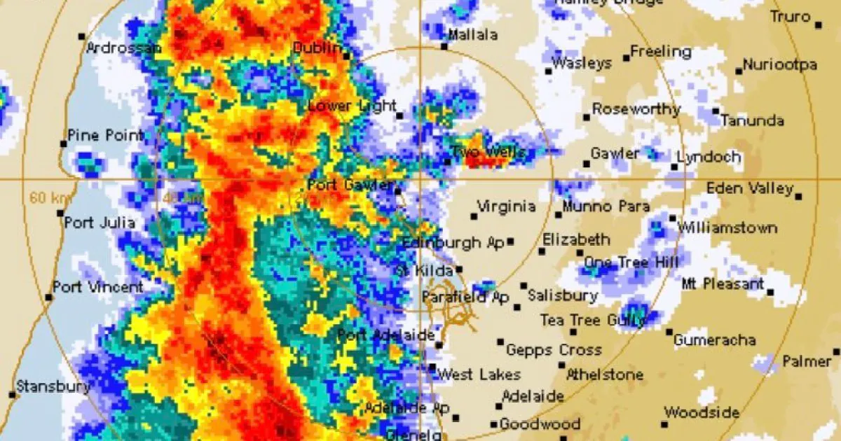
The storms have been intense, with 800 lightning strikes occurring over Adelaide this morning alone.
“We had those storms come through the city about 2 or 3am this morning, plus we got some storms going off just either side of the Spencer Gulf and further north in the North East Pastoral,” Mr Anderson said.


The severe weather has already caused disruptions, with Transport Minister Joe Szakacs announcing that the start of the tunnelling of the Torrens to Darlington project has been delayed due to the lightning.
The project was set to begin today, but the wild weather has forced a postponement.
Meanwhile, Marine Safety SA has warned the public to exercise caution when entering jetties at Thevenard, Fleurieu Peninsula, Lower Eyre Peninsula, South East and metropolitan Adelaide, as abnormally high tides may result in jetties being overtopped by waves.
But why is this wild weather occurring now? According to the Bureau of Meteorology, a low-pressure system is moving across the state, bringing with it strong winds and heavy rain.
The system is expected to move eastwards over the next 24 hours, bringing more severe weather to the state.
“We’re expecting these storms to be more of a wind risk than a heavy rainfall risk because there may only be seeing up to 20mm today, not just pouring cats and dogs all day but they are probably going to get more rainfall than we have,” Mr Anderson said.
Analysis: What This Means for Australia
The severe weather lashing South Australia is a timely reminder of the state’s vulnerability to extreme weather events. As the country continues to experience the impacts of climate change, it’s likely that we’ll see more frequent and intense storms in the future.
The economic and social consequences of these events can be significant, from damage to infrastructure and property to disruptions to daily life and business. As the state prepares for more wild weather, it’s essential that residents and visitors alike take necessary precautions to stay safe.
Security analysts say that the severe weather highlights the need for improved emergency preparedness and response measures.
“The fact that 50,000 lightning strikes were recorded in just 12 hours is a wake-up call for the state’s emergency services,” said one analyst.
“It’s essential that we have robust systems in place to respond to these types of events and keep the public safe.” Meanwhile, law enforcement insiders warn that the wild weather may also increase the risk of accidents and injuries on the state’s roads.
“We urge all drivers to exercise extreme caution and slow down in these conditions,” said one insider.