

Shockwave of Unseasonable Warmth Brings Fire Threat to Australia, But Polar Blast Looms
- Temperatures in south-east Australia shatter May records, with Hobart Airport reaching its highest maximum since 1936
- A cool, gusty and stormy change is expected to bring a wintry mix of showers, thunderstorms, hail, and snow to the region
- The abnormal heat is maintaining a fire threat well after the official end to the season, with out-of-season bushfires reported in Tasmania and NSW
- A lack of rain is allowing drought to spread through NSW, with 56% of the state now in a drought category
A spell of unseasonable warmth has gripped south-east Australia, bringing with it a fire threat that has seen out-of-season bushfires reported in Tasmania and NSW.
The heatwave, which has shattered May records in several states, is due to a stalled region of high pressure in the Tasman Sea.
This “blocking high” has prevented cold fronts from reaching the south-east mainland for nearly a fortnight, slowly dragging tropical air south and causing temperatures to climb.
The result has been a series of record-breaking temperatures, with Hobart Airport reaching its highest maximum since 1936. Adelaide, Melbourne, and dozens of other weather stations also broke records, with temperatures soaring more than 10 degrees Celsius above average.
But the warmth is not expected to last, with a cool, gusty and stormy change expected to bring a wintry mix of showers, thunderstorms, hail, and snow to the region.


The current weather pattern is in a state of flux, with the ingredients for the rest of the year’s climate still being determined. Warm northerly winds will continue to maintain highs in the mid-20s in Tasmania and southern Victoria, and close to 30C across inland NSW.
However, a cooler westerly airstream will drop temperatures in SA during the next 24 hours, before cooler air gradually filters through Tasmania, Victoria, and western and southern NSW during Sunday and Monday.
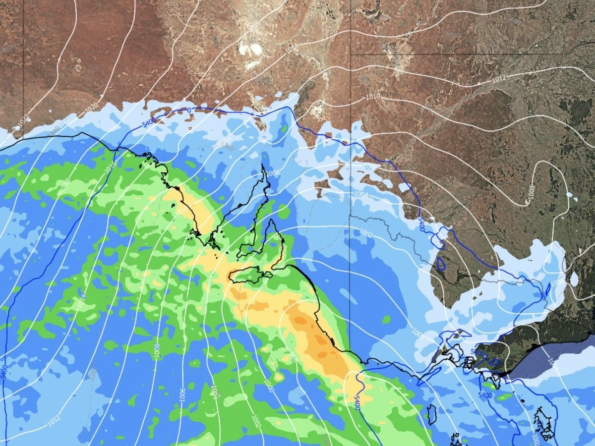
But the change will also deliver a band of showers and storms, starting in SA on Saturday and then moving east.
Rain totals from the system will be exceptionally variable, with anything from a drop or two to about 50 millimeters on the Alps and in pockets of northern Tasmania.
While rain is welcome across farming regions, there’s also the possibility of the odd severe storm with damaging wind gusts and flash flooding, including around Melbourne on Sunday.
Analysis: What This Means for Australia
The unseasonable warmth and subsequent cool change will have significant implications for Australia’s weather pattern.
The lack of rain is allowing drought to spread through NSW, with 56% of the state now in a drought category.
The Department of Primary Industries reports that long-term rainfall deficits continue to plague southern SA, along with most of Victoria and Tasmania after a dry 2024 and 2025.
Security analysts warn that the fire threat, which is being maintained well after the official end to the season, poses a significant risk to communities across the region.
The critical ground moisture metric used to calculate danger is root zone soil moisture (RZSM), which is currently in the lowest percentage rank over much of northern NSW.
This means that given a period of 100 years, current soil moisture levels are expected only once.
Law enforcement insiders also note that the unseasonable weather pattern is likely to put additional pressure on emergency services, which are already stretched due to the ongoing drought and bushfire season.
The possibility of severe storms and flash flooding will require careful planning and resource allocation to ensure public safety. Industry observers believe that the weather pattern will also have significant economic implications, particularly for the agricultural sector.
The lack of rain and subsequent drought will impact crop yields and livestock production, leading to economic losses for farmers and rural communities.
As the weather pattern continues to evolve, it’s clear that the next few days will be critical in determining the flavor of Australia’s climate for the rest of the year.
With the potential for severe storms, flash flooding, and even snow, it’s essential that communities across the region remain vigilant and prepared for any eventuality.
A spell of unseasonable warmth has gripped south-east Australia, bringing with it a fire threat that has seen out-of-season bushfires reported in Tasmania and NSW. The heatwave, which has shattered May records in several states, is due to a stalled region of high pressure in the Tasman Sea. This “blocking high” has prevented cold fronts from reaching the south-east mainland for nearly a fortnight, slowly dragging tropical air south and causing temperatures to climb.
The result has been a series of record-breaking temperatures, with Hobart Airport reaching its highest maximum since 1936. Adelaide, Melbourne, and dozens of other weather stations also broke records, with temperatures soaring more than 10 degrees Celsius above average. But the warmth is not expected to last, with a cool, gusty and stormy change expected to bring a wintry mix of showers, thunderstorms, hail, and snow to the region.