
‘El Niño Explosion’: Australia Braces for Record-Breaking Spring as Pacific Ocean Heats Up at Alarming Rate
- Australia faces its hottest spring on record, with temperatures expected to soar 2C above average, as El Niño strengthens across the Pacific Ocean.
- The rapid warming of the Pacific is contributing to extreme heatwaves and fires across Europe and North America, with global temperatures on track to reach record highs.
- The Bureau of Meteorology warns of a heightened risk of drought and bushfires, with rainfall expected to remain below average for the next three months.
- Experts fear a combination of high temperatures and low rainfall could dry out soils and enhance bushfires, with the southern half of the country most at risk.
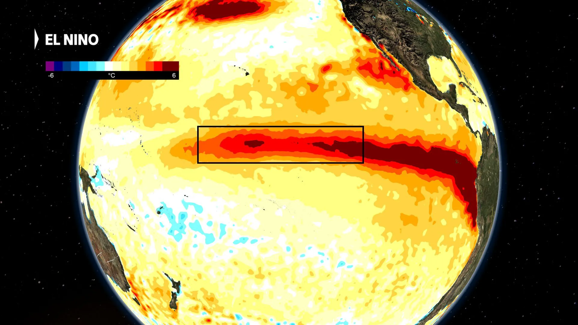
The Pacific Ocean is heating up at an alarming rate, with El Niño strengthening and threatening to smash all records in the modern era.
The rapid warming of the ocean is supplying additional heat into the Earth’s atmosphere, contributing to a summer of extreme heatwaves and fires across Europe and North America.
And Australia is not immune, with the Bureau of Meteorology warning of a heightened risk of drought and bushfires as the country faces its hottest spring on record.
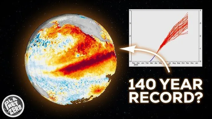
El Niño refers to a period of warmer-than-normal waters in the eastern and central Pacific Ocean, which can linger for up to 12 months.
According to the Bureau of Meteorology, there have been 27 El Niño years since 1900, and both observations and forecasts indicate that the 2026 El Niño is tracking into uncharted territory.
The Niño 3.4 index, a simple measure of the water temperature compared to average, has soared to nearly +2C, easily the fastest developing El Niño since 1900.
But why does a tongue of abnormal water temperature matter in the middle of the Pacific?
Climatologists and meteorologists pay close attention to El Niño because the shift in marine heat and currents leads to sweeping changes through the overlying atmosphere.
Australia is especially vulnerable due to its proximity to the Pacific, and past events have contributed to some of the country’s hottest and driest years on record.
Analysis: What This Means for Australia
The Southern Oscillation Index (SOI), a calculation of the pressure difference between Darwin and Tahiti, has already dived to nearly -30, well beyond the El Niño threshold of -7, and the lowest in more than 40 years.
This indicates that high-pressure is dominating Australian longitudes while lower than normal pressure is established over the central Pacific, reversing the typical easterly trade winds that bring tropical moisture to Australia.
As a result, national rainfall has fallen off a cliff during the past few weeks, and the prospects for a wet second half of 2026 are poor.
Security analysts say that the combination of high temperatures and low rainfall could dry out soils and enhance bushfires, with the southern half of the country most at risk.
Law enforcement insiders warn that the heightened risk of bushfires could put a strain on emergency services, while industry observers believe that the drought could have a devastating impact on Australia’s agriculture industry.
While rainfall during El Niño years typically returns to average by January, the effect on temperatures lingers into the new year, and the most likely outcome is a summer of extreme heat.
A combination of high temperatures and low rainfall is the greatest concern, and experts fear that it could lead to devastating bushfires.
However, unlike the lead-up to Black Summer, most of the nation is not in the middle of a long and severe drought, so it’s unlikely that bushfires will be widespread.
External factors, such as climate change, are also contributing to the strengthening of El Niño.
Average global sea surface temperatures have already reached record levels for more than a month, but the mass of oceanic warmth also acts like a heater, transferring immense amounts of thermal heat into the atmosphere.
Thanks to the background influence of climate change, strong El Niño events frequently send global air temperatures to record highs.
The planet’s hottest year, 2024, coincided with the back end of the last El Niño, and with this year’s episode already stronger, global temperatures are on a trajectory which may even see 2027 nearing the 2C warming above pre-industrial levels for the first time.
climate change is a major contributor to the strengthening of El Niño, and experts believe that it’s essential to address this issue to mitigate the effects of extreme weather events.
Australian Bureau of Meteorology provides regular updates on the El Niño event and its impact on Australia’s weather.