
‘Keep Your Wits About You’: Four States Brace for Violent Storms and Flash Flooding as Saturated Queensland Faces Major Mary River Flood Threat
- Up to 200mm of rain fell overnight inland of Bundaberg and Hervey Bay, leaving already waterlogged towns with almost no buffer against flash flooding.
- A major flood warning has been issued for the Mary River at Tiaro, with waters possibly breaking out as early as Sunday night.
- Brisbane, the Gold Coast, Sydney and Wollongong are all in the firing line for severe thunderstorms before the day is out.
- Brisbane SES volunteers responded to 180 callouts in a single day, and say many of those emergencies could have been avoided with basic home maintenance.
The ground is already full. The rivers are rising.
And the sky over eastern Australia is not finished yet.
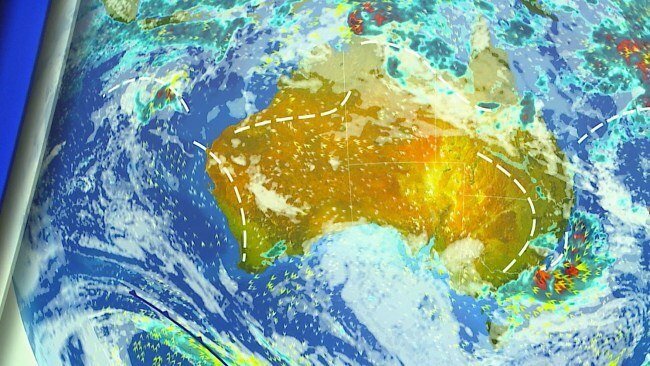
Millions of Australians from the Wide Bay to the Victorian high country are being urged to stay alert on Sunday as a powerful and unstable weather system threatens to unleash severe thunderstorms and dangerous flooding across four states and territories.
For communities in southeast Queensland, who have spent the past week watching the rain come down with barely a pause, the warning is blunt: any more water could turn streets into torrents within minutes.
The Bureau of Meteorology has flagged thunderstorm risks across Queensland, New South Wales, Victoria and the ACT, with flooding considered likely in parts of the region.
Queensland is expected to bear the brunt.
Overnight, heavy falls lashed the Wide Bay–Burnett district, with numerous rain gauges recording between 100mm and 200mm. Much of that deluge was concentrated just inland of Bundaberg and Hervey Bay, dumped onto catchments that had no capacity left to absorb it.
Bureau meteorologist David Crock described it as a particularly soaking week for the state’s southeast, warning that further downpours would trigger flash flooding very rapidly. He urged residents to stay vigilant.
Several flood warnings are now active across Queensland. The most serious is on the Mary River, where a major flood warning is in place for Tiaro.
According to the Bureau, the town could see flooding on Sunday night or into Monday morning.
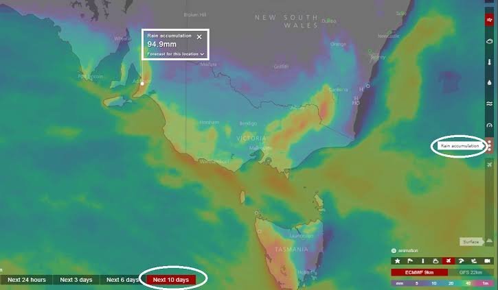
Further south and west, severe storms are forecast for southwest Queensland, a broad stretch of western NSW, the ACT and northeast Victoria.
By Sunday night, the danger zone could extend to some of the country’s most heavily populated coastal areas, including Brisbane, the Gold Coast, Sydney and Wollongong.
The Bureau says a moist, unstable airmass is sitting over most of NSW, with a vigorous trough expected to sweep through the state’s interior during the day.
Storms are already forming ahead of it and racing towards the southeast.
In Victoria, a separate trough is pushing east behind strong northwesterly winds, while a cold front moves through the state.
For the Mary River valley, the latest warning carries painful echoes.
The river has a long and destructive flood history, and communities along its banks, from Gympie to Maryborough, still bear the memory of the catastrophic floods of early 2022, when water swept through homes and businesses during one of the worst disasters in southeast Queensland’s recent history.
Tiaro sits squarely in that vulnerable corridor.
When the upstream catchment is soaked, as it is now, rainfall that might otherwise be absorbed flows almost straight into creeks and rivers, swelling them with alarming speed.
That is precisely why forecasters are so concerned. It is not simply the rain expected on Sunday that poses the threat.
It is the rain that has already fallen.
Across the east coast, the setup is classic spring volatility: warm, humid air colliding with troughs and cold fronts, producing storms capable of intense rainfall, damaging winds and hail in short, violent bursts.
Analysis: What This Means for Australia
Severe weather events of this scale are no longer rare interruptions. They are becoming a recurring test of Australia’s emergency preparedness, public infrastructure and community resilience.
The most immediate concern is public safety.
Flash flooding is among the deadliest natural hazards in the country, and a large proportion of flood-related deaths involve people driving or walking into floodwater.
When storms hit densely populated cities such as Sydney and Brisbane on a Sunday evening, the risk of motorists being caught out rises sharply.
There is also a growing strain on emergency services. Brisbane SES volunteers completed 180 jobs in just 24 hours on Saturday, before the worst of Sunday’s weather had even arrived.
These are largely unpaid volunteers, and repeated high-demand weekends test both their numbers and their stamina.
Tellingly, the SES noted that many of those callouts would have been avoided through basic home maintenance. Blocked gutters, loose roofing and unsecured outdoor items routinely turn manageable storms into emergencies, diverting crews from life-threatening incidents.
The economic consequences are equally significant.
Each major flood and storm event adds pressure to an already stretched insurance market, with premiums in flood-prone regions climbing steeply in recent years, according to the Insurance Council of Australia.
That feeds directly into the broader cost of living crisis and raises hard questions about where, and how, Australians can afford to live.
For regional towns like Tiaro, the burden falls hardest. Smaller communities often face slower recovery, disrupted supply chains and long-term damage to farmland and local businesses, compounding the social toll of repeated disasters.
Emergency management experts say the pattern seen this week, with days of persistent rain followed by a burst of severe storms, is exactly the kind of scenario that catches communities off guard.
Saturated soil, they warn, leaves virtually no margin for error.
Law enforcement insiders have long warned that the single most preventable cause of flood fatalities is drivers attempting to cross flooded roads, often underestimating how little moving water is needed to sweep a vehicle away.
Disaster resilience observers believe the SES’s message about home maintenance should be taken seriously, arguing that simple preparation by householders can ease the load on volunteers during peak events and allow crews to focus on genuine rescues.
Climate and weather analysts also point out that eastern Australia’s spring storm season appears to be delivering more intense rainfall bursts, reinforcing calls for stronger investment in flood mitigation and climate change adaptation across vulnerable catchments.
For now, authorities are urging Australians in affected areas to monitor radar, follow official warnings from the Bureau and their state emergency services, and secure their properties only when it is safe to do so.
Crock’s final warning was simple: there is wild weather heading across multiple states, and under no circumstances should anyone drive into floodwater.
In an emergency, residents should call Triple Zero. For flood and storm assistance, contact the State Emergency Service on 132 500.