
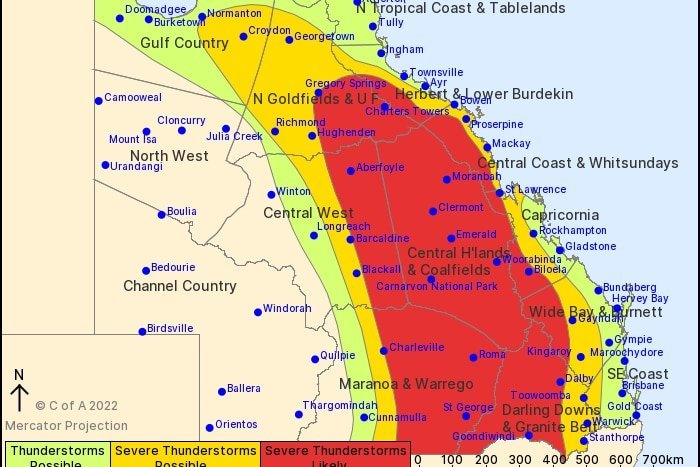
‘Giant Hail’ Warning as Supercell Storms Threaten Millions Across Queensland and NSW After Ice Chunks the Size of Cricket Balls Smash the Fraser Coast
- Hailstones measuring up to 10 centimetres pounded Queensland’s Fraser Coast overnight, piling up across roads in Maryborough like drifts of snow.
- Forecasters warn the atmosphere remains “highly unstable”, with supercells capable of destructive winds above 125km/h expected today.
- Brisbane, the Gold Coast, the Sunshine Coast and the Darling Downs are all in the firing line, with flash flooding a serious risk.
- Residents from the NSW south coast to the Fraser Coast have been urged to watch the radar closely as the danger peaks from late morning.
It came out of the night sky with terrifying force.
Chunks of ice as big as cricket balls hammered rooftops, cars and gardens across Queensland’s Fraser Coast, leaving shaken residents to survey a landscape that looked more like an alpine village than a subtropical seaside region.
And forecasters are warning the worst may be yet to come.
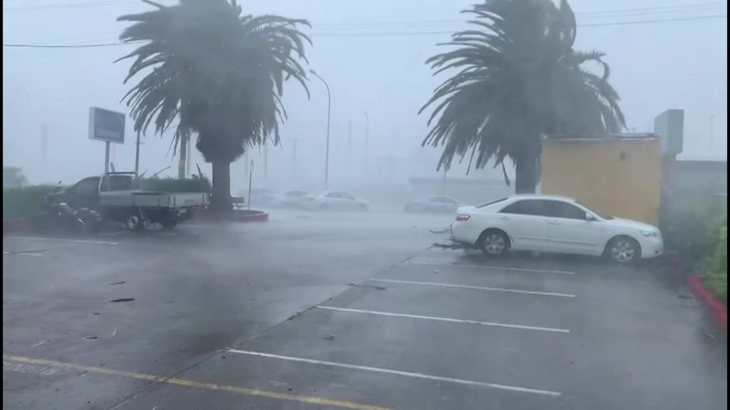
Millions of Australians along the eastern seaboard are now bracing for a dangerous day of supercell thunderstorms, with weather authorities cautioning that conditions remain primed for further violent outbreaks across south-east Queensland and north-east New South Wales.
The overnight onslaught delivered hailstones of up to 10 centimetres across the Fraser Coast.
In Maryborough, footage captured ice banked up along a roadway, while images from nearby Bidwill, supplied by local Vanessa Wright, showed the ground littered with frozen debris.
The culprit is a trough sitting over southern inland Queensland.
By this morning it had already sparked a line of severe storms, according to the Bureau of Meteorology, which has flagged damaging winds, large hail and flash flooding as live threats in the hours ahead.
Bureau meteorologist Jonathon How described the atmosphere as “highly unstable” and said a “significant” storm day was expected along a vast stretch of the east coast, reaching from the NSW south coast all the way north to the Fraser Coast.
Supercells, the most powerful and long-lived class of thunderstorm, could form across north-east NSW as well as south-east and central Queensland, he warned.
Mr How said there was a chance of “very dangerous thunderstorms” bringing destructive wind gusts exceeding 125 kilometres per hour, strong enough to topple trees and inflict damage on homes and other property.
He also cautioned that giant hail was possible, capable of causing substantial damage to vehicles.
Heavy rain and dangerous storms are forecast for Brisbane, the Gold Coast, the Sunshine Coast and the inland Darling Downs, putting some of the country’s fastest-growing population centres directly in harm’s way.
Mr How urged people across both regions to keep a close eye on the radar and on official warnings, particularly once the late morning and afternoon arrive, when storm activity is expected to intensify.
For long-time Queenslanders, the scenes are grimly familiar.
Spring and early summer routinely bring volatile weather to the state’s south-east, when warm, moist air from the coast collides with troughs pushing in from the interior.
The result can be explosive.
The region still carries the scars of the 2020 Halloween hailstorm, which battered Brisbane’s suburbs with giant ice and left insurers facing claims running well beyond a billion dollars.
More recently, the Christmas 2023 storms tore through the Gold Coast hinterland and Scenic Rim, bringing down trees, cutting power to tens of thousands and claiming lives.
Each event has served as a brutal reminder that a single afternoon of extreme weather can upend entire communities.
Today’s threat arrives as the severe weather season is only just getting into its stride, raising fears of a long and punishing few months ahead.
Analysis: What This Means for Australia
Beyond the dramatic images, storms like these pose a genuine public safety test for the nation’s most exposed communities.
South-east Queensland and northern NSW are home to millions of people, many living in suburbs that have sprung up rapidly over the past two decades.
Mature trees overhang power lines and homes, while stormwater systems in some areas struggle to cope with sudden downpours. When winds of 125km/h strike, the risk of injury from falling branches, flying debris and collapsing structures rises sharply.
Flash flooding presents perhaps the deadliest danger of all. Emergency services repeatedly plead with motorists not to drive through floodwater, yet every storm season brings fresh rescues and, too often, tragedy.
For emergency crews, a day of widespread supercells means stretched resources.
The Queensland Fire and Emergency Services and the NSW State Emergency Service can be inundated with calls for help with damaged roofs, fallen trees and rising water, all at once, across hundreds of kilometres.
The economic fallout can be equally severe. Hail of this size can write off cars, shatter windows and puncture roofing, triggering waves of insurance claims.
That feeds directly into rising premiums, adding pressure to households already grappling with the cost of living crisis. In some flood and storm-prone postcodes, cover is becoming prohibitively expensive, leaving families dangerously underinsured.
Farmers on the Darling Downs face their own anxieties, with hail capable of flattening crops in minutes and wiping out months of work just as harvest approaches.
There is also the question of resilience.
As climate change debates continue, communities are increasingly asking whether housing standards, urban planning and power infrastructure are keeping pace with the ferocity of modern storms.
Emergency management experts say the most important factor on days like this is how quickly people act on warnings.
Even a few minutes’ notice can be enough to move a car under cover, secure loose outdoor items or get away from windows before a cell hits.
Weather analysts note that supercells are notoriously difficult to pin down in advance, often forming quickly and tracking unpredictably. That uncertainty, they argue, is precisely why constant monitoring of radar and official alerts matters so much.
Insurance industry observers believe a major hail event in a heavily populated corridor such as Brisbane or the Gold Coast could once again trigger a surge in claims, warning that repeated catastrophes are reshaping the affordability of cover across Queensland.
Law enforcement and emergency insiders, meanwhile, stress that the biggest preventable risks remain on the roads, where drivers caught in blinding rain or floodwater put themselves and rescuers in danger.
For now, the message from authorities is blunt: the sky is loaded, the atmosphere is volatile, and residents across two states should be ready to take shelter at short notice.
Anyone in need of storm or flood assistance is urged to contact the SES, and to call triple zero in a life-threatening emergency.